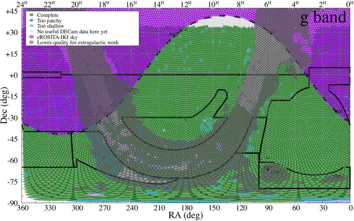
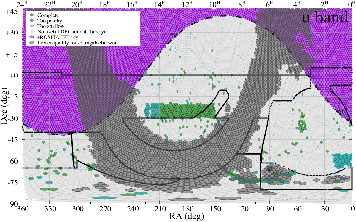
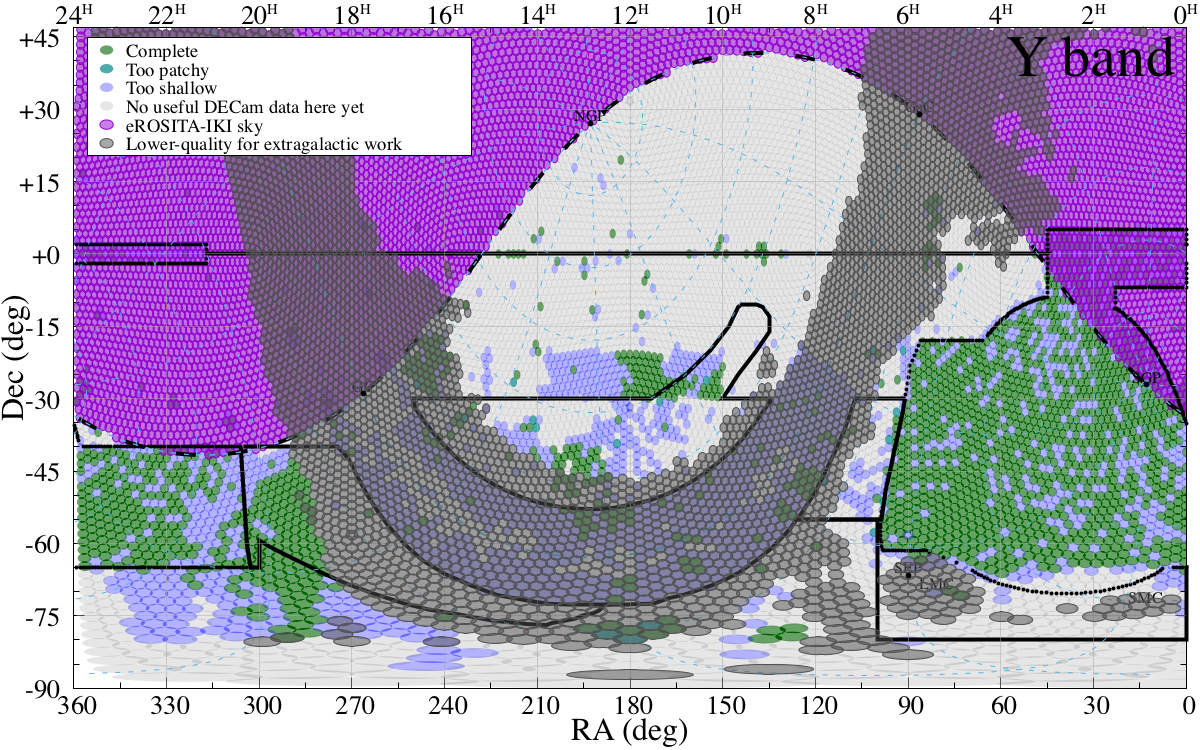
Here we describe the program progress (coverage and depth). Those plots were created using a (local) search in the DECam database.
The sky (and the current coverage as 20210906) in g,r,i, and z are:
Other Surveys:
Pan-STARR depths: grizy < 23.3, 23.2, 23.1, 22.3, 21.3 (3pi stack 5 sigma)
VST-ATLAS depths are similar to SDSS.
We can cover 1000 deg2 in 2.5n (check out this excel ETC).